

Pokemon Go maps are used for the robot delivery system’s navigation system
18.03.26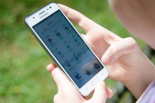
Augmented reality data collected in the mobile game Pokémon Go began to be used to navigate delivery robots. Niantic has turned its decades-old AR image database into a positioning system that allows devices to navigate cities with an accuracy of a few centimeters, TechSpot reports.
The technology is based on accumulated photographs and data that players collected while interacting with game points and objects in the real world.
AR data turned into a navigation system
The development is carried out by the company Niantic Spatial – a division in the field of artificial intelligence, created in 2025 as a spin-off of Niantic.
The basis of the technology was the visual positioning system (VPS). Unlike conventional GPS navigation, it determines the location of the device from the camera image and compares it with a database of photographs and cartographic context.
This scheme can significantly improve navigation accuracy, especially in dense urban areas where the satellite signal is often unstable.
Coco Robotics became the first partner
The first major partner of the project was the company Coco Robotics, which develops robot couriers for delivery along city sidewalks.
In cities in the United States and Europe, GPS positioning can have an error of tens of meters due to high-rise buildings and narrow streets. This is critical for robots: an error can lead to the device ending up on the next street or near the wrong entrance.
The new system solves this problem by analyzing images from the robot’s cameras. Algorithms compare frames with a large database of photographs of real locations.
Base trained on billions of images
The bulk of the visual data was collected by players of Pokémon Go and the company’s other AR game – Ingress. Users visited various points of interest and took photographs of the surrounding area, forming a large-scale database of images.
According to Niantic, Niantic Spatial models were trained on approximately 30 billion photos. A significant part of the photographs were taken in more than a million popular locations and from different angles – under different lighting, weather and time of day.
Combined with smartphone sensor data, this made it possible to create a detailed three-dimensional map of the urban environment.
Robots use cameras and a “living map”
Coco Robotics robots are equipped with four cameras aimed in different directions. They use a combination of GPS and Niantic Spatial visual localization, which improves the accuracy of position determination.
According to the company, such devices have already completed hundreds of thousands of deliveries and covered more than a million kilometers. Robots operate in cities in the USA and Europe, including Los Angeles, Chicago, Miami, Jersey City and Helsinki.
Niantic describes its system as a “living map” – a digital model of the world that is constantly updated. In the future, robots and other devices will be able to add new data while moving, gradually increasing the accuracy of navigation.
Thus, the technology, originally created to search for virtual creatures in Pokémon Go, can become one of the navigation tools for autonomous devices in real cities.
Don't miss interesting news
Subscribe to our channels and read announcements of high-tech news, tes

Oppo A6 Pro smartphone review: ambitious

 0
0 
Creating new mid-range smartphones is no easy task. Manufacturers have to balance performance, camera capabilities, displays, and the overall cost impact of each component. How the new Oppo A6 Pro balances these factors is discussed in our review.
Oppo Reno16 Pro 5G smartphone review: well-heeled
0 
Oppo Reno16 Pro 5G looks like a balanced smartphone, in which the manufacturer tried not to make a single characteristic the defining one. It has many advantages. Let’s tell you what
Huawei Readies Slimmer Watch D3 and New FreeBuds Neo

Huawei has teased the Watch D3 smartwatch with blood pressure monitoring and the new FreeBuds Neo earbuds. The official announcement is scheduled for September 2.
Made in Germany: Does the Gigaset GS6 Pro Live Up to the Hype?

The Gigaset GS6 Pro bets on German engineering and repairability. We explore what this status really means and whether it holds up against the competition.